Know More. Act Faster. With Real-Time Direction.

Visualize incidents instantly and guide responders along the fastest route with live mapping and detailed floor plans.

Get Started
Interactive Mapping

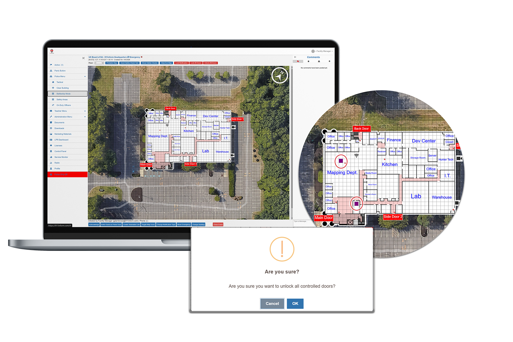
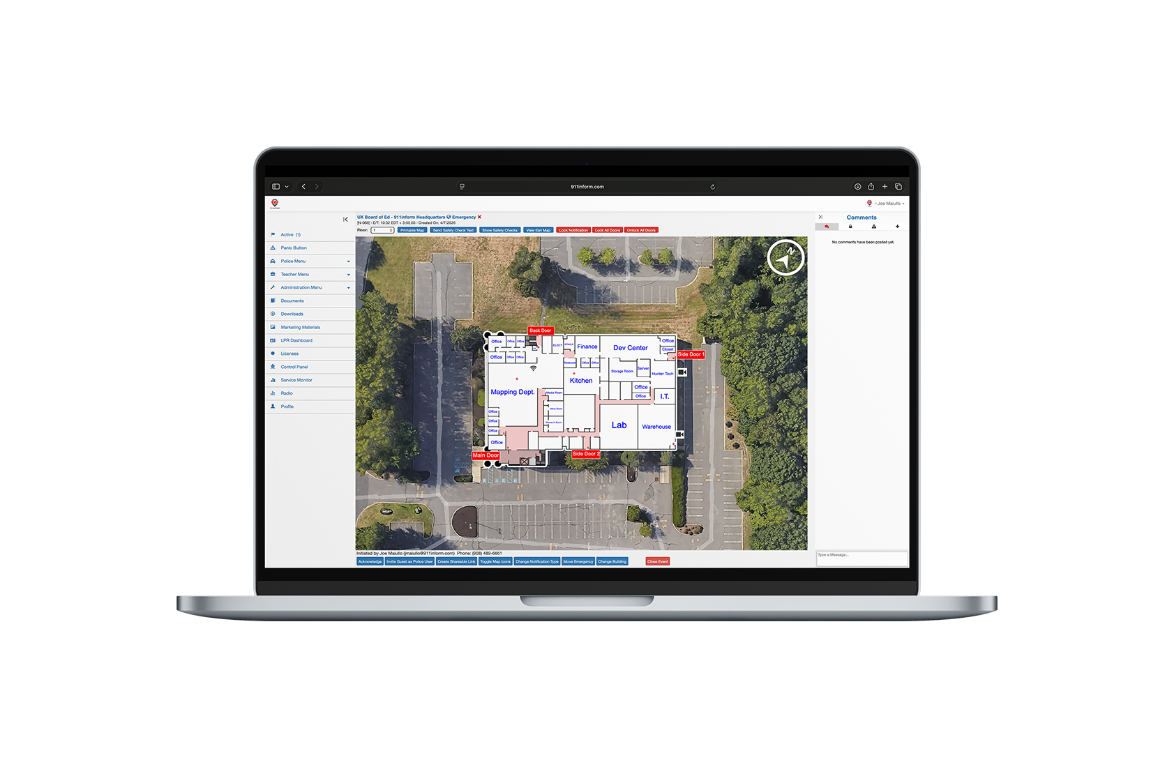
911inform’s Interactive Mapping transforms static floor plans into real-time operational intelligence, giving on-site teams and first responders a clear, live view of every emergency as it unfolds.

With precise indoor location, integrated systems, and guided response, users can see exactly where an incident is happening, access critical assets, and navigate the fastest path to respond, instantly and with confidence.


Real-Time Location Intelligence

Pinpoints the exact location of an incident within a building or campus the moment it is reported, giving responders immediate clarity on where to act.

Integrated Response Control

Connects with cameras, access control, and safety systems to enable live visibility and direct action from a single interface during an emergency.

Guided Coordination and Routing

Provides clear navigation and shared situational awareness so on-site teams and first responders can quickly reach and manage the scene with precision.
Credit card mockups

911INFORM Interactive Mapping
Frequently Asked Questions

What is 911inform Interactive Mapping?

911inform Interactive Mapping converts static building floor plans into a live operational view of an emergency. When an incident is reported, the map opens for authorized on-site staff and responding agencies, showing the pinpointed incident location, the fastest route to and from it, and access to connected cameras, doors, and safety systems from the same interface.

Do we have to create the map ourselves?

No you do not have to create the map yourself. 911inform builds custom interactive maps from your existing floor plan.

Can police see our floor plans and cameras when there's no emergency?

Access is tied to an active emergency event rather than granted standing. Camera access is opened to public safety personnel when an event is activated and removed for all parties once the event is closed. Outside of an active event, responders do not have live access to your building systems.

What maps and imagery does 911inform use?

Interactive Mapping overlays your building floor plans onto Google or ESRI base maps, so responders see interior detail in the context of the surrounding property, parking areas, and approach routes. Geofences and property boundaries are rendered on the same view.

How does emergency routing work?

911inform's patented emergency routing displays in-building routes to and from the incident on the Interactive Map, including approach through controlled doors. Because routing is drawn on the same map that carries door controls and camera feeds, a responder following the route can unlock doors along it without switching systems.

Can we map a multi-building campus?

Yes. Maps and geofences support multi-building campuses, and a single geofence can encompass an entire property, multiple buildings, grounds, and parking areas. 911inform has over 21,000 maps and 13,000 buildings deployed across its customer base.
Know More. Act Faster.

Keep up-to-date user location information readily available to emergency dispatchers

Who We Are

911inform is the only all-encompassing platform to help emergency response teams better manage communication and connected-building controls directly related to an emergency. Our solution provides emergency notifications to dispatch, first responders and key building personnel seconds after a 911 emergency phone call is placed within a 911inform geofenced building location. Our software is activated, through PBX phone or smartphone, and provides an emergency notification to all required parties, as well as the exact location (within 3 meters of accuracy) of the emergency event location. We then hand the connected-building controls to dispatch and emergency response teams, allowing them to use the video surveillance feeds, voice control systems and door access capabilities directly related to the emergency, ensuring that they can arrive on scene as quickly as possible and be better prepared when they do.


Other Solutions

Connected Building

Learn More

Visitor Management

Learn More

Geofencing

Learn More

Panic Buttons

Learn More

Location Discovery Solution

Learn More
Security Practices

911inform continues to be committed to the security of its clients in an ever-evolving cybersecurity landscape and continues to adopt new methods to ensure that 911inform, as well as customer data both, remain protected.

Arise Health logoThe Paak logoOE logo2020INC logoEphicient logoEphicient logoEphicient logoEphicient logo